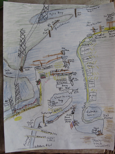
What it might mean to make maps

We have now mapped the tiny corner of our creek and given names to nameless places, extending human dominion to yet another junkyard and mudflat.

Chart of Pete's Harbor and Environs

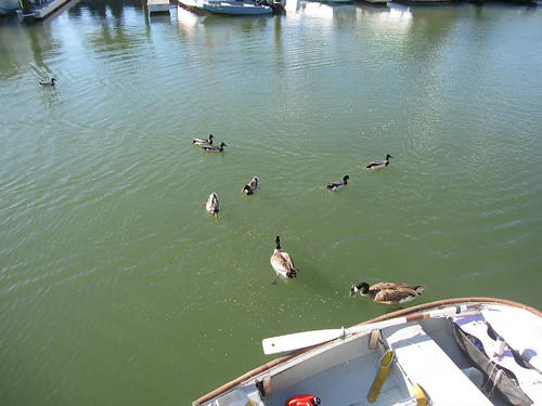
As I kayaked around with my friend Adina she babbled to me charmingly of how we were in the same place but in a different place. Everything about the land and the water became different because we were on the water looking at the land. I agree! Distances open up hugely and pinch themselves up into almost nothing depending on the wind and current and tide. The parking lot of an office, a boring place, turns out to be the best fishing spot on the creek, full of families hanging off their truck tailgates.

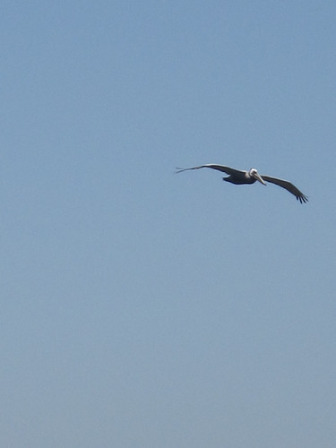
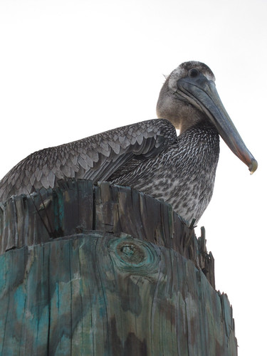
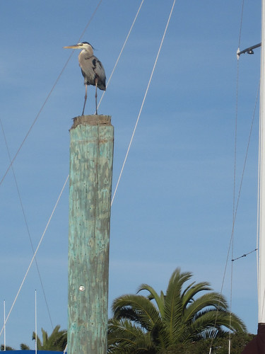
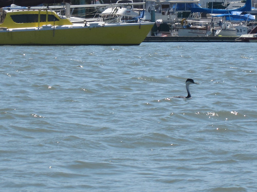
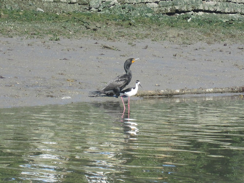
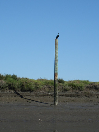
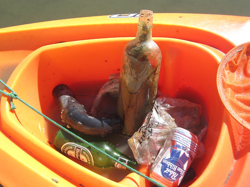
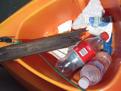
Many of my names for the creek are jokes but they reflect the way we are using the creek as kayakers and what we think is important. The places where trash collects, the strength of the current, the mudflats, the sticks and pilings and pylons that are landmarks, the place where the grebes hang out, the wind shadow of Middle Bair Island.

We remap our minds by traversing the edge of the known map. I was thinking about frontiers, wastelands, and edges. At Open Source Bridge I said some stuff about wastelands. When you hear a place described as empty, reach for your gun. Just kidding. No, when you hear a place described as empty, you can be sure someone is exploiting it. The desert, the wasteland, and the frontier, are obfuscations.

So in my naming of these places I open up different possibilities of exploitation, but since no space is unnamed and unobserved — they are named and observed and mapped by governments and corporations — I would prefer that they be named and observed in a decentralized way by anyone at all. (Which is one reason I adore Open Street Map and Open Sea Map.)

Voyages

As I look back on the history of Bair Island and Redwood Creek I keep finding ghost places – like “South Shores” which was an attempt by a developer to rename the slough as a suburban extension of “Redwood Shores”. Or like Deepwater Slough, which still has a faint track on the satellite photo – the C shaped trace that loops across Middle Bair, across from the Port – the dredged mud and pickleweed it encloses still privately owned and still named “Pacific Shores” probably for some totally screwed up future condo development scheme.

Bair Island EIR map

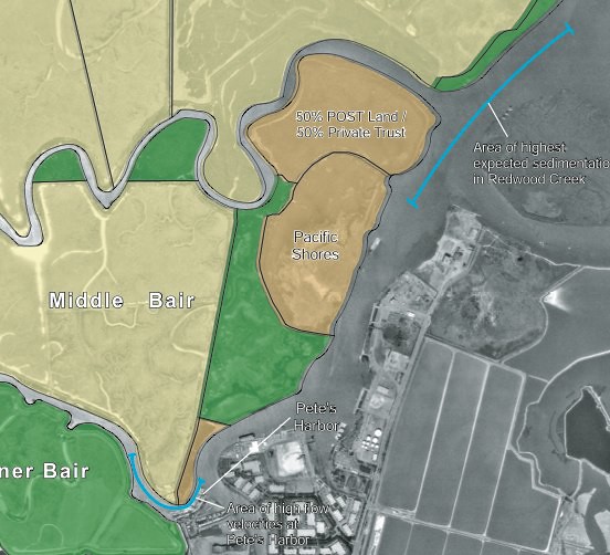
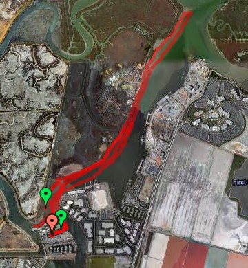
The Bair Island history, its battles, and its 2006 EIR are all deep background good for anyone interested in the proposed 12,000 household development of the wetlands-turned-salt-ponds owned by Cargill. On the maps they’re the pink rectangular areas that barely even look like bay anymore.

A neighbor of mine across the harbor is gearing up for that battle on another blog, Virtual Saltworks. The ponds are still part of the bay and still supposed to be open space and wetlands. We could use a little bit of digging into maps and history – what was First Slough like before it was diked? What would it take to restore it at least to the state that Bair Island and Corkscrew Slough are in now?

Soon the abandoned docks and the piers for electric company access to overhead cables will be decorated underneath by pirate mailboxes where Milo and I will leave secret messages for the world.

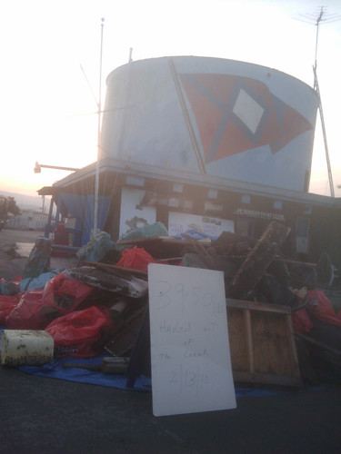
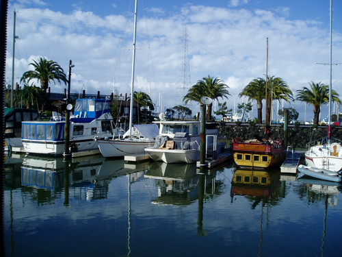
I have some great ideas for Community Kayaks. They’d be like the civic projects for free bicycles anyone can use without fuss. It would be very easy and cheap to start and maintain a simple flotilla of boats free for anyone to use. More local people would use Redwood Creek, would see the edge of our town, the cultivated-wild places that exist right next to the industrial port where oceangoing cargo vessels offload their gypsum, sand, and gravel and load up clanking waterfalls of scrap metal. People barely care about the Creek because they don’t know it’s there. If they paddled around on it they might get fond of it.

I got a little obsessed with the Alviso boat ramp opening. If you live in Redwood City – do you know where the public boat launch ramps are? There are two that I know of!

What is the Bay for? Who gets to go on it? You shouldn’t have to be rich – or go on a giant ferryboat – or treat it like a sort of horrible wet golf course –

Where are my beautiful floating islands made of trash and full of ecological minded Burning Man hippies cultivating flats of pickleweed and nesting habitats for Caspian Terns? I also imagine a beautiful anarchosocialist cooperative marina with art projects and rogue marine science. It would be easy for us here in the harbor to be monitoring water quality, observing the plants and birds and fish, and so on. Decentralized maps and some kind of visionary open data project could make for some great open source science – I’m sure someone’s doing this already.

Birds of Redwood Creek, Bair Island, and Smith Slough

I’ve been steadily exploring Redwood Creek and the slough around Bair Island from my houseboat in Pete’s Harbor, getting to know the birds of different seasons and the plant life as well as the patterns of wind and current. The human activity on the creek is mostly from tiny boats puttering around from Docktown to Pete’s Harbor to the city marina; tiny planes overhead on their way in and out of San Carlos airport; sailboats and crew and outrigger canoes from Bair Island Aquatic Center and the Stanford boathouse; and further downstream, the huge, fascinating, industrial Port of Redwood City.

I’ll start with the birds.

Brown Pelicans are fairly common. There were many living in the harbor itself over the winter, but they began to migrate elsewhere in the spring months. There’s always one or two out over Redwood Creek next to Bair Island, gliding and diving. They perch on pilings and sit on the floating docks near my boat, wary but tolerant of human approach. You’ve probably seen the heartbreaking photos of pelicans covered in oil from the BP oil spill in the Gulf of Mexico. Here’s some happy pelicans who live in Redwood City to cheer you up!

voyage to buoy 20

pelican

Terns, possibly more than one species of tern, showed up in mid-spring and are swooping over the harbor and river, catching tiny fish. They make a funny clicking noise almost like blue jays scolding. While I’m kayaking, terns fly right overhead and plunge into the water a foot or two from my boat. They’re incredibly graceful and a bit saucy. You can tell them from gulls a long way off from their swooping flight, black head, long beak, and curvy wings.

voyage to buoy 20

Great Blue Herons are a bit more rare. I see them most commonly in the early morning, evening, or far into Smith Slough away from the harbor itself. But they come into the harbor and hang out, even perching on dinghys and boat rails. When we see one, we stop paddling and glide as slowly as possible so as not to disturb it. They’re very shy.

great blue heron

Egrets are easy to spot all over the Bair islands, often visible from the Pete’s Harbor parking lots on Inner or Middle Bair or from the viewing trail. From the kayak, I most often see them in the tiny inlet we call “Pylon Bay”.

Western Grebes come right into the harbor, but they can almost always be found in a little flock next to Middle Bair Island right where the slough meets the creek, between Pete’s Harbor and the Marine Science Institute. They scatter when the crew boats row by in the early morning and evening. I’ve seen these grebes do the preliminary steps to their mating flights — pairing up and head pumping, copying each other, but not the full “walking on water” part. The grebes are everywhere in Redwood Creek and seem to be very successful in their fishing.

Grebe

Coots are around, but less common in the creek. We have one resident coot who hangs around C and G Docks in the harbor, named Wacko by my neighbors. It hovers around the little flocks of ducks and sticks close to the shadows of the boats and docks during the day.

Wacko the coot

Ducks, seagulls, and small Canada Geese are extremely common around the harbor and Bair Island. I feed them (and Wacko the Coot) handfuls of duck chow in the evening from the back of my boat. A couple of weeks ago, I saw three pairs of Canada geese with 7 chicks, between the Bair view trail and Inner Bair Island, but the goose families with goslings haven’t come into the harbor. My neighbors have said that every year the ducks have lots of ducklings, most of which don’t make it to adulthood as they get eaten by herons and seagulls.

Ducks and geese

During a low tide, especially a minus tide, we see a lot of night herons. They’re very shy and wary, but they still perch on the docks to fish. It’s nice to see them out on the mudflats in a minus tide, along with phalaropes, plovers, peeps, black necked stilts, avocets, and what I think might be whimbrels. I love night herons because they look so fierce and grumpy.

night heron

I don’t have many photos of the avocets and stilts. I see them most often at the minus tides or way out in the slough. The closest point I expect to find stilts is in the slough in between Inner Bair and Middle Bair Island. Here’s a stilt right by Pete’s Harbor at a minus tide in the early morning, near the place we call Castle Point.

cormorant and black necked stilt

Cormorants are common and quite beautiful! They and the pelicans remind me of little dinosaurs. We recognize them a long way away from their low sleek profile sitting on the water, very different from the shape of a grebe, or from their characteristic posture perched on pilings, docks, or pylons, with wings outspread. The dock near the pylon across from the Pete’s Harbor laundry room, and the pylon itself by the Bair Island viewing trail, are pretty much guaranteed to be festooned with cormorants any time you look. I conclude that they must make a successful living from the creek and the area immediately around the harbor.

Spring Break

Cormorant

Red tailed hawks glide over Middle and Inner Bair Islands, hunting. Some small mammals must live there. A few years ago I saw rabbits boxing each other on Inner Bair, while it was still home to a hiking trail.

Red tailed hawk on a pylon

Though I haven’t seen a Clapper Rail, I’m pretty sure I’ve heard one over by Inner Bair Island: they sound like creaky machinery.

On Bair Island itself, there are swallows, red-winged blackbirds, finches, and other small songbirds I haven’t identified.

You can see quite a lot of these birds from the Bair Island viewing trail or from the Pete’s Harbor parking lot near the Waterfront Restaurant. To get to the viewing trail, get off Highway 101 at Whipple and go on Whipple towards the Bay, away from the city. You will pass some car dealerships and the old movie theater. The road curves around to the left, past the foot and bike bridge that goes across the creek to Main Street. Keep going past the Diving Pelican Cafe. Across from the Bair Island condos and a big empty field, just before the railing, road, and walkway that leads to the Pete’s Harbor ship on land that’s painted like the Italian flag, there is a tiny trail and a “Shore Access” sign. Park in the lot across the street from the trail.

Along the gravelled trail, there are two natural history signs that have information about the marsh. There are benches where you can sit to look out over the slough. If you walk about halfway down the trail towards Whipple, there is a tiny sand pit and playground good for toddlers to play in. Bikes can make it up this trail all the way to Whipple. Strollers are okay up until the halfway mark at the sand pit. It’s not very accessible for wheelchairs but not impossible if you can make it up the steep gravelled slope that starts the trail — I can make it only with a push from behind, but can do the trail after that despite the shallow gravel up until the sand pit. Past the sand pit, the trail is narrow and rough.

Leave a comment if you birdwatch around this area and let me know what you see!

Morning trash from Redwood Creek

Here’s the kayak full of trash I picked up early this morning at low tide in Redwood Creek. It was a short, leisurely voyage in a glassy calm that made it easy to spot floating plastic bags and bottles.

Trash picked up from Redwood Creek

The big glass bottle looks old to me, so I’m going to wash it out and keep it.

During unusually high tides there’s usually a lot of fast food containers, plastic bottlecaps, and styrofoam packing peanuts as well as a lemon or two.

Most of the time I forget to take a photo, but here’s another day’s worth of trash:

voyage to buoy 20

The most fertile grounds for trash are right up Redwood Creek past Highway 101. It’s only good to go there during a high tide at slack water.

On Valentine’s Day this year the Peninsula Yacht Club at Docktown led a big effort to pull trash from the creekside. In one day, they hauled out almost 2 tons of junk!

Peninsula Yacht Club

I think in the summer, Beth from Fake Plastic Fish might come do a trash collection voyage with me. Her blog is pretty cool – take a look. She lived for a year without consuming more than 5 pounds of plastic and she’s basically an activist against unnecessary plastic. After collecting trash from the creek, and during moments like watching seagulls fight over a coke bottle screw top and then one of them eating it, I can sure see where she’s coming from. The plastic bags in the marsh look like jellyfish floating.

In the Maldives there is an island made entirely of trash, Thilafushi Island. It’s built out of garbage and looks like an interesting place despite surely leaching out pollutants and hosting some industrial processing plants.

The island has grown to such proportions that it now has a café, a restaurant, two mosques, a barbershop, a clinic, a police station and rather unexpectedly, a makeshift zoo.

If we had a floating trash island in the San Francisco Bay, its growth would need to be limited, but it could be a very interesting place for eco-tourism or trash management tourism. I picture this floating trash island as a step further than Forbes Island or Spiral Island II, but smaller than Thilafushi. It could be a colony where people come stay and camp for a month and do volunteer Bay cleanup work with Trash Island as their base. There should also be a coffee cart and a nature center. It would be way more exciting to visit than Yet Another Bike Trail with Dogwalkers And Joggers In A Landfill. The price of admission would be that you take away a bag of trash. Okay, this is a half-baked idea… While I like the vision of seasteading as places for independent states, I tend to come up with slightly less ambitious ideas for cooperatively owned marinas or coastal cities with floating platforms that share some common purpose or radical politics — ecological cleanup and monitoring, public coastal access, and maybe some really cool art. In fact, I think that seasteading colonies will need to foster marinas with progressive politics in order to be viable. Seasteading needs a sort of marine-stuff-ecosystem in order to be viable. That might mean developing a close relationship with a working port city, or buying up and running its own port.

Speaking of public access! You should go to the Alviso Public Boat Ramp re-opening! Free kayak rides for kids and I’m sure a great party in a place with a long, interesting history.

Living in a boat

A month ago I moved onto a boat, a 37 foot Chris Craft Catalina built in 1987. The engine is in scattered rusted pieces. There’s a faint bilgey, seaweedy smell and a gentle rocking motion. Pelicans, grebes, coots, ducks, geese, scaups, cormorants, and night herons hang around the harbor outside my window.

harbor

Last night for the first time, during a minus tide (a perigean spring tide) the boat grounded on the muddy bottom. Then there was a moment where the boat began to sway again – it had lifted off and we were floating. I looked out at the christmas lights in the rigging next door and realized we were at our usual height relationship again, with a view of the canvas roof over their cockpit. While we were both grounded, their deeper keel hit bottom first, and their boat towered over us so that I was looking into their lower portholes from my cabin window.

It’s all a bit like a trailer park in a very wet parking lot. Some people’s boats sail out into the bay or to far destinations. Others, like mine, stay put except for the promise and motion of the tide. People who have boats, and who live aboard their boats, seem to share a particular romanticism, dreaminess and the attachment of meaning to possibilities of a nomadic life, or a sense of needed refuge, shown in lists of the most popular boat names over the years.

Tides are complicated. On this part of the coast we get mixed tides — with high water and low water twice a day, and one set of high and low points higher than the other. The tide moves north along the U.S. west coast because of the Coriolis effect. Here in the bay, down a marshy creek channel and in the middle of a slough, the tidal range is still over 8 feet. Floating docks and finger docks are loosely connected to piers by huge metal rings. Sometimes we on the boats, and the docks that bridge the water, are up at the level of the parking lot. At low tide, the ramp from the parking lot to the docks is quite steep.

Dock steps with a handrail lead up to my boat. Between the main cabin and the other rooms, there are a few more steps. These are still hard for me to negotiate, especially stepping down. But through the stress of moving I’ve held up very well. Now that I’m settled in, the constant small variations of the steps between rooms, with resting possible in bed or in the living room and kitchen, are making my knees stronger.

The head in the aft (captain’s) cabin works well. The forward head has been in pieces for over a week, waiting for an out of stock valve to be shipped to one of a small group of my neighbors who have been in and out of the boat to study the valves and hoses below deck and the disassembled hoses attached to the toilet itself. I’ve learned a little bit about marine heads in the meantime. Everyone here gets to know the marine shop and the RV supply places, and, I think, the workings of each other’s boats.

The boat had two circuits of 30 amps each. Space heaters, the microwave, and the toaster oven use the most amps and can potentially flip some circuit breakers. There’s a 12 volt circuit too for the boat’s batteries, and the bilge pump runs on that. Though the water and electricity are hooked up to the city services, I’m suddenly more aware of them as finite resources, and am now much more moderate in my use of both. My neighbors can see the water I use to wash dishes, as it’s pumped out over the side. The toilets’ holding tank is pumped out twice a month into a boat with a giant holding tank, with all our sewage sloshing around visibly inside.

A small subset of my books fills three half-size bookshelves. I brought a lot of books about exploration and the sea, fiction and non-fiction. So far the best one has been The Loss of the Ship Essex, Sunk By a Whale. Three survivors from the 1820 wreck of a whaling ship tell the story of the whale’s attack, a long journey in three open boats, starvation, thirst, fear, and cannibalism. My other favorite book just now, a present from Oblomovka, is The Queen of Whale Cay, about a woman named Joe Carstairs who drove ambulances in WWI, raced motorboats, had about a zillion lovers including Marlene Dietrich, and bought her own island in the Bahamas which she ruled feudal or colonial style until the 1960s. Every paragraph of the book was full of new outrageousness. I also brought some books of poems to translate, and some of my favorite poets like Ginsberg and Alta.

By comparison to many other towns on the Peninsula, Redwood City has kept a little bit of its working class industry and feel, in part because it’s a working deep water port. Ships from China and South Korea bring construction materials, like gypsum and rock for cement. They leave filled with scrap metal. On one side, a complex of tall buildings is built around a rocky artificial stream, then some salt ponds shade towards more slough and a landfill to the south. On the north side of the port, there’s a yacht harbor surrounded by tech and genetics companies in a chain of long low buildings and their oceanic parking lots. Then, bits of slough and winding creek channels. At the point where Redwood Creek crosses 101, there’s a marina called Docktown, with some enormous “floating homes” built on pontoons, and boats ranging down to the “barely floating” category. There are lots of flowerpots and dogs and amazing, attractive clutter, and a completely non-snooty yacht club. I like it there. My boat is in Pete’s Harbor, a quiet marina just across the creek and around a point, facing Bair Island and Smith Slough. The liveaboards here all seem to know each other and it’s a good community. Two newer marinas in town, West Point and Bair Island, are stricter in their rules and are out to attract a richer set of residents. But my impression of Docktown and Pete’s Harbor is that people here are just regular — not wealthy yacht owners — and in fact it’s very affordable to live on the water here once you have the boat and a slip to rent. The politics of the existence of marinas seems as complicated as tides and less predictable. Here is an area in flux, whose ownership is a bit unclear or is municipally owned. Would it even be possible to own a tiny bit of the coastline in the bay, here? Could it be possible for a consortium or co-operative to buy up some land and own their own personal boat slips, rather than renting the slips? I wonder, too, if that would inevitably lead to people filling in the spaces between docks and new land pushing outward into the Bay, as much of San Francisco was built on docks and filled in to become land, owned and controlled rather than the liminal space that coastlines seem to be.

As I read about the complexities of tides I learned about amphidromic points, places in the ocean where because of the Coriolis effect, the topography of the sea floor or the nearby landmasses, the tidal range is zero. The tides here keep me noticing things and alert to this small bit of the world. I’m paying attention to weather and watching the marine buoys nearest to the harbor.

Anyway, the changes in my life have been overwhelming and absorbing, so much that I haven’t been blogging much or spending time online, other t
han for work. I need to jump back in, though, and in a couple of weeks am leaving for New Zealand for linux.conf.au and DrupalSouth. Wellington is on Cook Strait, between the North and South Islands of New Zealand. On the east coast, high tide comes at the same time as low tide on the west coast. So the current through the channel is fierce and for various reasons, nearly unpredictable. A bit like my interest in geology and gardening and compost made me notice dirt and rocks and want to learn about the geological history of every place I go — seeing a landscape as a potential narrative over the scale of geologic time and simultaneously from the point of view of a gardener — living aboard a boat (which happened somewhat by chance as I looked for a cheap place to live in my town on Craigslist) has given me a new overlay or template or lens to view the rest of the world. So there’s a new set of things to learn and notice, everywhere I go, which makes me feel incredibly lucky and happy. The rock and soil based lens of my view is about deep history and rootedness, and how to settle and blend into that landscape, making a sort of habitat or ecosystem where I make a home for birds and bugs, getting back some tomatoes and oregano and flowers. Here on the water in my glorified floating trailer, I find I’ve made the same sort of cozy domesticity inside the house, but outside, there’s no feeling of rootedness or connection. I’m detatched, ephemeral, temporarily in residence, trying not to make an impact with my biodegradable soap, an observer and traveller. What would it be like, living in a spaceship? It’s like what that anthropologist whose name I can’t recall wrote about the attractions of waiting rooms and hotel lobbies. But rather than waiting in an impersonal static lobby for a particular event, I’m a temporary resident along with the ducks and herons as enormous forces keep our world in flux.